01
Altitude at departure point: 345 mt
Day 1: Arrival in Pont St Martin
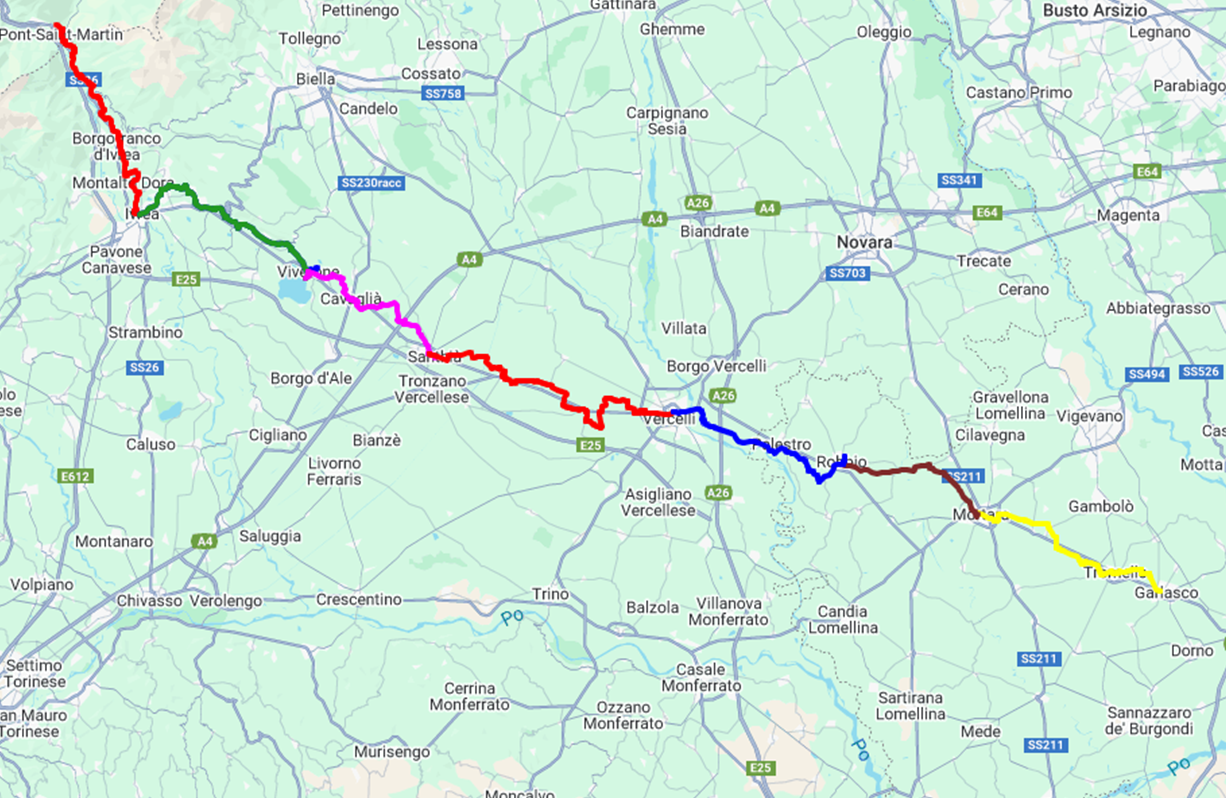
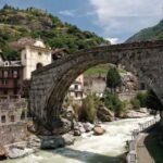
The departure point of the first stage is Pont Saint Martin, little village located on the frontier between Valle d’Aosta and Piedmont. It owes its name to the Roman bridge dating back in the I century B.C. . The second part of the name honors the Saint. In the neighborhood there is also the Strada delle Gallie (Gaul’s’ road), which arrived almost intact nowadays, with its pavement, one column and the arch built in the granite.
02
Distance 24 km
Day 2: Pont St Martin - Ivrea
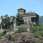
Today the itinerary winds among countryside areas, little villages and woods. From the hills located in the north of Ivrea, you will see, in the distance Montalto castle, a huge fortress with high towers dated back to 1300. The stage ends in Ivrea, located on the banks of the river Dora Baltea. In the towns you will find some important remains of the Roman Age and from medieval times, when Ivrea was protected by its walls and divided in “rioni” (quarters).
03
Distance 21 km
Day 3: Ivrea - Viverone
The first part of the today’s stage take place through open countryside. Interesting, the little village of Bollengo, the second part goes across the hills and offers nice views on the valley and then on the Lake of Viverone, with crystalline water and rich in uncontaminated plant and wildlife. Really nice to visit is the near village of Piverone, with the interesting Bell Tower.
Height at the arrival 287 mt
04
Distance 18 km
Day 4: Viverone - Santhià
After a quite walk along the lake of Viverone, you continues through a nice wooded area to cross one of the last hills before the agricultural plain. The fields gets the upper hand little by little while you reach Santhià, first village you meet during the long passage of the Padana plain. Santhià is an agricultural and industrial centre where two branches of the Francigena Way join on: one towards the Gran San Bernardo Pass and the other one towards the Susa Valley.
Height at the arrival 183 mt
05
Distance 29,7 km
Day 5: Santhià - Vercelli
This is the first stage completely flat. During spring the wide area of fields around Vercelli became a boundless water expanse, thanks to a complex net of water channels built for rice cultivation. The city of Vercelli is at the junction of two branches of the Francigena Way (Jacob toward Turin and Susa Valley, and Sigeric toward Valle d’Aosta). The medieval Cavour square is entirely surrounded by ancient houses with porch and the renowned Basilica of Saint Andrew is an absolute masterpiece of Romanesque-Gothic of North Italy.
Height at the arrival 130 mt
06
Distance 19,5 km
Day 6: Vercelli - Robbio
Out of Vercelli, after a short walk in the countryside, you walk along the banks of the river Sesia. The itinerary becomes wooded, and you cross the border between Piedmont and Lombardy. Near Palestro, you will leave the river and shortly you reach Robbio. This town is on the consular street that led to Gallie and had an important role since the ancient times. Today it is an agricultural and industrial centre in the pavese plain. TRAIN TO MORTARA AT THE END OF THE WALK.
Height at the arrival 120 mt
07
Distance 20 km
Day 7: Mortara - Garlasco
The today’s stage crosses the pavese countryside: farmhouses and imposing rural houses are like little dots among the wide cultivated fields. You will spend the night in Mortara which is the home of the Salame d’Oca (goose Salami) and it hosts an historical “palio” dating back to 1400, during which takes place the famous ”game of the goose”. Garlasco is well known for the Sanctuary of Madonna della Bozzola, 4 km from the town centre.
Height at the arrival 93 mt
08
Day 8: End our service
See you next year to walk together the next stage

